Gesamtpreis (1 Artikel Artikel):
Versandziel:

cosmographia von ptolemaeus claudius (12 Ergebnisse)
Feedback
Direkt zu den wichtigsten Suchergebnissen
Suchfilter
Produktart
- Alle Product Types
- B³cher (12)
- Magazine & Zeitschriften (Keine weiteren Ergebnisse entsprechen dieser Verfeinerung)
- Comics (Keine weiteren Ergebnisse entsprechen dieser Verfeinerung)
- Noten (Keine weiteren Ergebnisse entsprechen dieser Verfeinerung)
- Kunst, Grafik & Poster (Keine weiteren Ergebnisse entsprechen dieser Verfeinerung)
- Fotografien (Keine weiteren Ergebnisse entsprechen dieser Verfeinerung)
- Karten (Keine weiteren Ergebnisse entsprechen dieser Verfeinerung)
- Manuskripte & Papierantiquitõten (Keine weiteren Ergebnisse entsprechen dieser Verfeinerung)
Zustand
- Alle
- Neu (Keine weiteren Ergebnisse entsprechen dieser Verfeinerung)
- Antiquarisch (12)
Einband
- alle Einbõnde
- Hardcover (5)
- Softcover (Keine weiteren Ergebnisse entsprechen dieser Verfeinerung)
Weitere Eigenschaften
- Erstausgabe (2)
- Signiert (Keine weiteren Ergebnisse entsprechen dieser Verfeinerung)
- Schutzumschlag (1)
- Angebotsfoto (8)
Sprache (3)
Preis
- Beliebiger Preis
- Weniger als EUR 20 (Keine weiteren Ergebnisse entsprechen dieser Verfeinerung)
- EUR 20 bis EUR 45 (Keine weiteren Ergebnisse entsprechen dieser Verfeinerung)
- Mehr als EUR 45
Gratisversand
Land des Verkõufers
Verkõuferbewertung
-

Cosmographia Roma, 1478.
Verlag: Amsterdam Theatrum Orbis Terrarum, 1966
Anbieter: Antiquariat "Der B³chergõrtner", St. Ingbert, Deutschland
Verkõuferbewertung 5 von 5 Sternen

EUR 160,00
Wõhrung umrechnenEUR 20,00 f³r den Versand von Deutschland nach USAAnzahl: 1 verf³gbar
In den WarenkorbZustand des Schutzumschlags: mit Schutzumschlag. Erste Auflage dieser Ausgabe. 30 x 43 cm. Erste Auflage, XIII, nicht paginiert. Goldgeprõgte OLwd, OU. Karten. Leichte Lagerungsspuren am OU. Hinweis: Versandkosten m³ssen bei Auslandsversand evtl. angehoben werden.
-
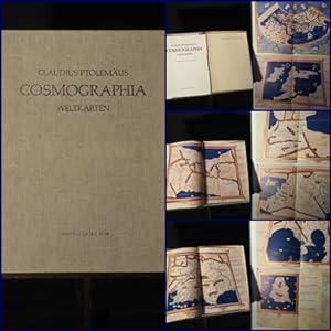
Cosmographia : Weltkarten / Claudius Ptolemõus. Einl. und Anm. von Lelio Pagani. [Aus dem Ital. ³bertr. von Isolde Hõrth-Ragaller] .
Verlag: W³rzburg : Popp ,, 1977
Anbieter: Antiquariat Hartmut R. Schreyer, Augsburg, Deutschland
Verkõuferbewertung 5 von 5 Sternen
EUR 180,00
Wõhrung umrechnenEUR 12,00 f³r den Versand von Deutschland nach USAAnzahl: 1 verf³gbar
In den Warenkorb[12] S., XXVII Bl. : 27 doppelblattgr., farbige Karten ; 46 cm . Orig.-Leinen-Kassette. In 800 num. Expln. - (gut erhalten).
-
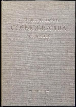
Die Cosmographia des Claudius Ptolemõus. Codex Urbinas Latinus 277. [Faksimileband apart]
Verlag: Z³rich, Belser Verlag, 1983
Sprache: Latein
Anbieter: Antiquariat Lenzen, D³sseldorf, Deutschland
Verbandsmitglied: GIAQ ILAB VDA
Verkõuferbewertung 5 von 5 Sternen
Erstausgabe
Faksimileband: 62 x 46 cm. Kassette: 87 x 51 cm. 135, [2] Blatt; 80 Seiten. Original-Ganzlederband mit reicher Blind- und Goldprõgung, 10 Messingbeschlõgen und Lederriemenschlie▀en mit Messingverschl³ssen und Original-Pappband mit goldgeprõgtem Titel in Original-Schmuckkassette aus Holz, die als Lesepult zusammengesetzt werden kann. (Codices e Vaticanis selecti, LIII). Nummer 132 von 250 Exemplaren der Prachtausgabe, Nummer 161 der Gesamtauflage von 550 Exemplaren. Ausgabe in Latein. Mit 44 farbigen und goldgeh÷hten Karten (davon 29 doppelblattgro▀), zahlreichen farbigen und goldgeh÷hten Miniaturen, Bord³ren und goldgeh÷hten Initialen auf floral verziertem Farbgrund. Monumentale Faksimileausgabe. Ohne den Kommentarband. Die "Geographike Hyphegesis" des Ptolemaeus entstand um das Jahr 150 n.Chr. als umfassende, kartografische Darstellung der bis dahin bekannten Welt. In der lateinischen ▄bersetzung durch den italienischen Gelehrten Jacobus Angelus entz³ndete sie erneut die Flamme der Begeisterung bei den humanistischen Gelehrten und Adligen. Die vorliegende Handschrift (Urb. lat. 277) wurde von Ugo Comminelli aus MķziĶres in Florenz geschrieben und im Jahre 1472/73 abgeschlossen. Karten und Buchschmuck entstammen bedeutenden italienischen K³nstlern wie Francesco Rosselli und Pietro del Massaio. Sehr gutes Exemplar. Original full leather binding with elaborate blind and gilt tooling, 10 brass fittings, leather strap fastenings with brass clasps, and the original cardboard binding with gilt-embossed title, housed in the original decorative wooden box that can be assembled into a reading desk. Number 132 of 250 copies of the deluxe edition, number 161 of the total edition of 550 copies. Edition in Latin. Includes 44 coloured and gold-highlighted maps (29 of which are double-page), numerous coloured and gold-highlighted miniatures, borders, and gold-highlighted initials on floral-decorated backgrounds. A monumental facsimile edition. Without the commentary volume. The "Geographike Hyphegesis" by Ptolemy was created around 150 AD as a comprehensive cartographic representation of the known world at that time. In its Latin translation by the Italian scholar Jacobus Angelus, it reignited enthusiasm among humanist scholars and nobles. The manuscript at hand (Urb. lat. 277) was written by Ugo Comminelli of MķziĶres in Florence and completed in 1472/73. The maps and book decorations were created by prominent Italian artists such as Francesco Rosselli and Pietro del Massaio. An excellent copy in very good condition.
-
Die Cosmographia des Claudius Ptolemõus. Codex Urbinas Latinus 277. 2 Bõnde [Faksimileausgabe mit Einf³hrungsband]
Verlag: Z³rich, Belser Verlag, 1983
Sprache: Latein
Anbieter: Antiquariat Lenzen, D³sseldorf, Deutschland
Verbandsmitglied: GIAQ ILAB VDA
Verkõuferbewertung 5 von 5 Sternen
Erstausgabe
Faksimileband: 62 x 46 cm. Kassette: 87 x 51 cm. 135, [2] Blatt; 80 Seiten. Original-Ganzlederband mit reicher Blind- und Goldprõgung, 10 Messingbeschlõgen und Lederriemenschlie▀en mit Messingverschl³ssen und Original-Pappband mit goldgeprõgtem Titel in Original-Schmuckkassette aus Holz, die als Lesepult zusammengesetzt werden kann. (Codices e Vaticanis selecti, LIII). Nummer 69 von 250 Exemplaren der Prachtausgabe (Gesamtauflage 550 Exemplare). Ausgabe in Latein. Mit 44 farbigen und goldgeh÷hten Karten (davon 29 doppelblattgro▀), zahlreichen farbigen und goldgeh÷hten Miniaturen, Bord³ren und goldgeh÷hten Initialen auf floral verziertem Farbgrund. Monumentale Faksimileausgabe. Die "Geographike Hyphegesis" des Ptolemaeus entstand um das Jahr 150 n.Chr. als umfassende, kartografische Darstellung der bis dahin bekannten Welt. In der lateinischen ▄bersetzung durch den italienischen Gelehrten Jacobus Angelus entz³ndete sie erneut die Flamme der Begeisterung bei den humanistischen Gelehrten und Adligen. Die vorliegende Handschrift (Urb. lat. 277) wurde von Ugo Comminelli aus MķziĶres in Florenz geschrieben und im Jahre 1472/73 abgeschlossen. Karten und Buchschmuck entstammen bedeutenden italienischen K³nstlern wie Francesco Rosselli und Pietro del Massaio. Vorderdeckel des Faksimilebandes an einer Kante mit kleiner Schabstelle (ca. 0,5 cm), ein Doppelblatt lose, ansonsten tadelloses Exemplar. Original full leather binding with rich blind and gold embossing, 10 brass fittings, fastenings of leather and brass and original cardboard with gold embossed title together in original wooden case which can be assembled as a lectern. Number 69 of 250 copies of the edition de luxe (total print run 550 copies). Edition in Latin. With 44 colored and gilt maps (29 of them double-page size), numerous miniatures, borders and initials each colored and gilt. Monumental facsimile edition. Ptolemy's "Geographike Hyphegesis" was written around 150 AD. as a comprehensive, cartographic representation of the then known world. The Latin translation by the Italian scholar Jacobus Angelus, it rekindled the flame amongst humanist scholars and nobles. The manuscript at hand (Urb. lat. 277) was written by Ugo Comminelli from MķziĶres in Florence and completed in 1472/73. Maps and decorations were designed by important Italian artists such as Francesco Rosselli and Pietro del Massaio. Edge of the facsimile front cover with a small scuffed spot (approx. 0.5 cm), one double page loose, otherwise fine copy.
-
Cosmographia. Weltkarten. Einleitung und Anmerkungen von Lelio Pagani.
Verlag: Edition Georg Popp, W³rzburg, 1977
Anbieter: terrahe.oswald, Gangkofen, Deutschland
Verbandsmitglied: BOEV ILAB VDA
Verkõuferbewertung 5 von 5 Sternen
EUR 140,00
Wõhrung umrechnenEUR 23,00 f³r den Versand von Deutschland nach USAAnzahl: 1 verf³gbar
In den WarenkorbFolio. Mit 27 farbigen doppelblattgro▀en Karten. (12) S. Kommentar. In Orig.-Leinenschatulle. Cosmographia - Weltkarten. Faksimile der 27 Karten und Kommentar. Aus dem Italienischen von Isolde Hõrth-Ragaller. - Ecken der Mappe etwas besto▀en; Vorderdeckel der Mappe gering angeschmutzt; itelblatt mit kleinem Fleck.
-
Cosmographia. Weltkarten. Einleitung und Anmerkungen von Lelio Pagani.
Verlag: W³rzburg, Popp, 1977
ISBN 10: 3881550232 ISBN 13: 9783881550239
Anbieter: Antiquariat Lenzen, D³sseldorf, Deutschland
Verbandsmitglied: GIAQ ILAB VDA
Verkõuferbewertung 5 von 5 Sternen
Folio. 46 cm. [12] Seiten, XXVII Blatt. Original-Leinenmappe. 1. Auflage. Mit 27 gefalteten, farbigen Karten. Leinenkassette wenig angestaubt. Sehr gutes Exemplar.
-
Die Cosmographia des Claudius Ptolemaeus 1472. (Facsimilie of Codex Urbinas Latinus, no 277, in Bibliotheca Apostolica Vaticana, Rome)
Anbieter: Herman H. J. Lynge & S°n ILAB-ABF, Copenhagen, Dõnemark
Verkõuferbewertung 4 von 5 Sternen

EUR 2.207,16
Wõhrung umrechnenKostenlos f³r den Versand von Dõnemark nach USAAnzahl: 1 verf³gbar
In den WarenkorbZurich & New York, Besler and Johnson, 1982-1983. Large folio (620 by 460 mm). In the original magnificent full calf binding with blind-tooled ornamentation, gilt centrepiece, brass centre and corner pieces and two leather clasps. No. 54 out of 500 copies. A fine and clean copy. 135, (2) pp. With a total of 44 maps of which 29 are double-page. 1 leaf, the world map, loosely inserted as usual. Accompanying the atlas is a commentary-volume in half calf. 88, (6) pp. An outstanding facsimile of the Vatican's Ptolemy Cosmographia of 1472, no. 277 in the Vatican Library. This present copy being no. 54 of only 500 copies produced. The manuscript was written by Ugo Comminelli from MķziĶres in Florence and completed in 1472/73. Maps and decorations were designed by important Italian artists such as Francesco Rosselli and Pietro del Massaio.
-
Cosmographia.
Verlag: Petri de Turre,, Rome,, 1490
Anbieter: Daniel Crouch Rare Books Ltd, London, Vereinigtes K÷nigreich
Verbandsmitglied: ABA ILAB PBFA
Verkõuferbewertung 4 von 5 Sternen
EUR 362.112,03
Wõhrung umrechnenEUR 23,44 f³r den Versand von Vereinigtes K÷nigreich nach USAAnzahl: 1 verf³gbar
In den WarenkorbSecond Rome edition with the "finest Ptolemaic plates produced until Gerard Mercator" Folio (425 by 282mm), loose endpaper/initial blank on different paper, minor wormholes to first two gatherings, occasional minor staining to margins not affecting text, very occasional manuscript annotations in faded ink, 27 double-page engraved maps, minor staining to world map, some loss to right edge of 'Quinta Asia Tabula' not affecting printed area, 'Sexta Asia Tabula' with small closed tear to title, small open tear to right edge and some brown staining, some minor brown staining to 'Decima Asia Tabula', minor wormholes to final two gatherings. Contemporary calf decorated in blind with intricate roll tool borders enclosing central diamond with woven rope motif, clasps with cross straps replaced, some areas of repair including triangular area c50-60mm to upper cover and small area to lower left hand corner of lower cover, early paper label with manuscript lettering in iron gall ink. Collation: A8 (first leaf blank) B-C8, D6 (second leaf incorrectly signed D3), E6, a10 (first leaf blank), b-g8, h3 (lacking final blank leaf), 27 engraved maps, 2a8 (2a1r blank, 2a1v registrum super tractum de tribus orbis partibus, 2a2r-2c5r de locis ac mirabilibus mundi et primo de tribus orbis partibus), 2b8, 2c6 (lacking final blank leaf, 2c5r colophon: Hoc opus Ptholomei memorabile quidem et insigne exactissima diligentia castigatum iucondo quodam caractere impressum fuit et completum Rome anno a nativitate Domini .M.CCCC.LXXXX die .IV. Novembris. arte ac impensis Petri de Turre, 2c5v blank). Watermark: text leaves watermarked with a cross within a circle, maps watermarked with a cardinals hat. The "handsome" second Rome edition of Ptolemy's 'Geographia' (Scammell). The plates for the Rome editions of Ptolemy were several years in the making, and they are considered to be "the finest Ptolemaic plates produced until Gerard Mercator engraved his classical world atlas" a century later (Shirley). They were produced by two German printers, Conrad Sweynheym and Arnold Buckinck, and "it is believed that Sweynheym was the one who first thought of applying the very new art of copper-engraving to the printing of maps, and he might have taken a hand in the actual engraving of them himself " (Scammell). The first edition was printed in 1478, and the present edition was printed 12 years later from the same plates. While the Bologna edition of 1477 was the first atlas and edition of Ptolemy to use copperplate maps, the Rome edition is generally regarded as superior for its clear captions, accurate projections and overall design. It includes more geographical details, including names in Arabia, in particular. Unusually, the seas are pock-marked. The early Italian Ptolemys, particularly the Rome editions, are "superb testimonials of Italian craftsmanship without the picturesque but unscientific monsters of the medieval maps or the addition of the adventitious decoration of later work, relying for their beauty solely on the delicacy of their execution and the fineness of the material employed" (Tooley). As Tooley observes, the maps in the atlas have no external border decorations or co-ordinate lines, relying instead on the clarity of the engraving. BMC IV, 133; BSB-Ink P-861; Goff P-1086; HC 13541; Nordenski÷ld 7; Sabin 66474; Shirley 4; Scammell, The World Encompassed 40; Tooley, Landmarks of Mapmaking.
-
Die Cosmographia des Claudius Ptolemaeus 1472/3
Verlag: Besler and Johnson,, Zurich & New York
Anbieter: Daniel Crouch Rare Books Ltd, London, Vereinigtes K÷nigreich
Verbandsmitglied: ABA ILAB PBFA
Verkõuferbewertung 4 von 5 Sternen
EUR 7.242,24
Wõhrung umrechnenEUR 23,44 f³r den Versand von Vereinigtes K÷nigreich nach USAAnzahl: 1 verf³gbar
In den WarenkorbSuperb facsimile of the Vatican's Ptolemy Cosmographia of 1472 Folio atlas (620 by 460mm), 135pp., [2] leaves, full colour facsimile reproduction of the Vatican Codex Urb. Lat. 277., full blind tooled calf with gilt centrepiece, brass centre and corner pieces, leather clasps. Superb facsimile of Ptolemy's Cosmographia, published by the Vatican. The original manuscript was commissioned by the Duke of Urbino in 1472/3, and came into the Vatican Library in 1657. In 1983 the Vatican Library published 550 facsimiles; 500 of which were meant for sale and fifty - each marked with a Roman numeral I-L - to be kept by the Library, for use as state gifts. The present copy is marked with the Roman numerals 'VII'. One such example was presented by Pope Benedict XVI to Christian Wulff, the President of Germany, during his Apostolic visit to Germany, on the 22nd September 2011. The press release that accompanied the gift gives a general history of the work: "This facsimile reproduces the manuscript containing the Latin translation of the Greek text (version "A") of the Geographia by Claudius Ptolemy (2nd century AD), performed by Iacopo Angeli da Scarperia (around 1360-1410). The title Cosmographia, which seemed the most appropriate to the author, was based on choices made by other Latin authors for similar works (the reasons why are explained in folio 2v). Together with other, similar specimens this magnificent manuscript documents the rediscovery and positive reappraisal during the Renaissance of Ptolemy's cartographic oeuvre, as a synthesis of Hellenistic culture and a recognised milestone in the representation of the earth, unique among its kind in terms of the wealth of theoretical and practical information it provides on the topic. The codex was transcribed in Florence in an elegant, humanist script by Hugues Commineau (Ugo Comminelli) de MķziĶres (see colophon folio 70r; in abridged form folio 122r), the same copyist of the splendid Bible of Urbino (Urb. Lat. 1-2). Pietro del Massaio and Francesco Rosselli were also involved in its production: both were well known as illuminators thanks to their workshops, which were specialised in the manufacture of maps and geographical works. The embellishment is valuable; this begins with the title page (folio 1v), which contains a sumptuously enframed reference to the title and the translator in gold on a blue background; the incipit of the translator's foreword (folio 2r) is decorated along the edges with gold and coloured borders comprised of flowers, putti with candelabras (also a recurrent motif in the initials of the text) and medallions, plus an illumination showing the translator presenting the work to Pope Alexander V (wrongly identified as Alexander III). The incipit of each book includes delightful initials painted in miniature; colourful frames embellish the introductory texts to the maps that follow. The text is divided into eight books. Book I (folios 3r13r) explains the theoretical concept of 'geographia' and methods for designing maps; books IIVII (folios 13r-69r) contain information on the names of towns and cities, countries, regions and peoples of the world together with their coordinates; book VIII (folios 69r-70r) details the number of maps and provinces for each continent, and includes short descriptions and data on the main cities etc. These books are followed by the 27 maps traditionally ascribed to Ptolemy: the entire world as it was then known (folios 72v-73r), then 10 maps of Europe (folios 74v-92r; Germany is on folio 80r), 4 maps of Africa (92v-100r), 12 of Asia (100v-121r). Then come seven non-traditional maps or 'novae' (folios 122v-129r), and 10 city- and townscapes (folios 129v-135r). The sequence is determined by a practical cartographic criterion. The more than 8,000 locations named are entered in a grid of longitudes and latitudes, which Ptolemy is the first to use in the modern sense. The codex belonged to the library of Federico da Montefeltro, Duke of Urbino (1422- 1482), which was acquired by Pope Alexander VII and thus reached the Vatican library in 1657. The present binding of the work, made of brown leather embellished with the coats of arms of Pope Pius VI (1775-1799) and the cardinal librarian Francesco Saverio de Zelada (1779-1801), is dated at between 1779 and 1799; we know of two previous bindings. For a limited number of copies of the facsimile a valuable binding was selected, manufactured after the original of another work by Ptolemy from the late 15th century and taken from the same library (Urb. Gr. 82) [Claudia Montuschi (BAV)].".
-
Cosmographia - Weltkarten. Faksimile der 27 Karten und Kommentar. Aus dem Italienischen von Isolde Hõrth-Ragaller.
Verlag: Edition Georg Popp, W³rzburg 1977, 1977
Sprache: Deutsch
Anbieter: Antiquariat Stefan Wulf, Berlin, Deutschland
Verkõuferbewertung 5 von 5 Sternen
EUR 250,00
Wõhrung umrechnenEUR 18,70 f³r den Versand von Deutschland nach USAAnzahl: 1 verf³gbar
In den Warenkorbgoldgepr. Ganzleinenkasette. Folio, 6 Bll. (Kommentar), 27 doppelblattgro▀e in Farbe faksimilierte Karten. Vollstõndig. Die Kassette mit leichteren Gebrauchspuren. Nummer 110 der handschriftlich nummerierten Gesamtauflage von 800 Exemplaren. Nummer 110 der handschriftlich nummerierten Gesamtauflage von 800 Exemplaren. 5010 g.
-

Cosmographia (Geographiae): Italia et Corsica, sexta Europae tabula.
Verlag: Basel Heinrich Petri / 1552, 1545
Sprache: Latein
Anbieter: Versandantiquariat Christine Laist, Seeheim-Jugenheim, Deutschland
Verkõuferbewertung 5 von 5 Sternen
EUR 245,00
Wõhrung umrechnenEUR 30,00 f³r den Versand von Deutschland nach USAAnzahl: 1 verf³gbar
In den WarenkorbOriginal-Kartenfragment der Italienkarte (17 x 24,5 cm), auf der R³ckseite mit dem Titel der sechsten europõischen Karte des Ptolomaeus in breitem Holzschnittrahmen mit 10 Holzschnittfiguren. Saubere Karte. Karte von Korsika und Norditalien des Universalgelehrten Ptolemaios aus Alexandrien. Seine im 2. Jhd. n. Chr. erstellten Werke blieben bis ins 15. Jhd in Euroipa unbekannt und hatten dann aber bis ins 16. Jhd hinein eine hohe Bedeutung, da die Karten auf der Grundlage wissenschaftlich ermittelter Daten gezeichnet wurden und die damals bekannte Welt ohne Ungeheur auf Meer und Land darstellte. Das Kartenfragment ist laut Auskunft der Niedersaechsischen Staats- und Universitõtsbibliothek auf die Mitte des 16. Jahrhunderts zu datieren und "entspricht den Holzst÷cken der beiden Petri-Ausgaben von 1545 und 1552" des Ptolomaeus. Das Fragment zeigt die Insel Korsika, Teile von Sardinien und den Norden Italiens. Drei Ortsnamen in Norditalen wurden mit lesbareren Typen gedruckt. Im unteren Bereich mit kl. Sammlerstempel.
-
Cosmographia (GWM 36374, HC 13540). Blatt aus: Siria libro quinto.
Verlag: Ulm Johann Reger f³r Justus de Albano 21 Juli Type 1, 1486
Sprache: Latein
Anbieter: Versandantiquariat Christine Laist, Seeheim-Jugenheim, Deutschland
Verkõuferbewertung 5 von 5 Sternen
EUR 420,00
Wõhrung umrechnenEUR 30,00 f³r den Versand von Deutschland nach USAAnzahl: 1 verf³gbar
In den WarenkorbZweispaltiges, 44-zeiliges Original-Inkunabelblatt mit einer 6-zeiligen altkolorierten Initiale "S" (4 x 4 cm). Blatt im Rand wasserrandig. Blatt im unteren Rand mit Defekten. Blattgr÷▀e: 28,6 x 41 cm. - - -.

![Bild des Verkõufers f³r Die Cosmographia des Claudius Ptolemõus. Codex Urbinas Latinus 277. [Faksimileband apart] zum Verkauf von Antiquariat Lenzen](https://pictures.abebooks.com/inventory/md/md32018538188.jpg)
![Bild des Verkõufers f³r Die Cosmographia des Claudius Ptolemõus. Codex Urbinas Latinus 277. 2 Bõnde [Faksimileausgabe mit Einf³hrungsband] zum Verkauf von Antiquariat Lenzen](https://pictures.abebooks.com/inventory/md/md31651856511.jpg)